

ANONYMIZED INDUSTRIAL PROOF
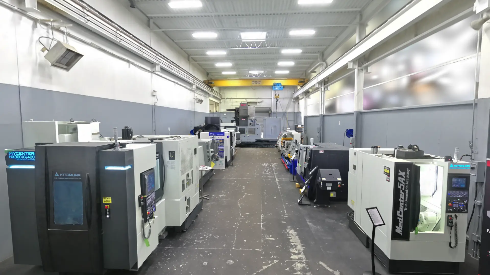
Southern Ontario machine-tool showroom facility twin.
A planning-grade mobile SLAM LiDAR and 3DGS capture of a real showroom and demonstration facility, prepared as a reusable browser experience for spatial review.
LIGHTWEIGHT PREVIEW
Understand the captured space before launching the viewer.
This short video is a preview of the historical capture. The full interactive twin remains an on-demand action so the proof page stays useful on mobile and slower connections.
RECORD CONTEXT
A facility twin represents a date and version—not an eternal current state.
Capture once. Reuse it until the facility changes. Update it when the plant changes.
- Capture date
- 21 July 2026
- Facility-twin version
- 2.0.0
- Areas included
- Primary showroom and machine-display areas; LiDAR and 3DGS representations; 10 guided viewpoints; 5 machine tags.
- Important exclusions
- Offices and private areas; inaccessible or occluded surfaces; hidden utilities and internal machine details; live operational or sensor data.
- Current or historical?
- Historical demonstration capture. It should not be used as evidence of current facility conditions.
What was delivered?
The example combines a LiDAR point-cloud representation, a photoreal 3D Gaussian Splatting representation and a browser-ready facility-twin experience. Guided viewpoints and machine tags help a visitor orient themselves without specialist desktop software.
The twin is a reusable spatial record. It is not a live operational digital twin because no changing sensor, machine or production data is connected.
Why use both LiDAR and 3DGS?
Mobile SLAM LiDAR carries planning-grade geometry and measurement context. 3DGS carries the recognizable visual experience. Keeping those roles explicit helps a team know which representation should support a given question. Critical dimensions still require independent verification using the appropriate method.
What should an industrial buyer notice?
- The facility is understandable without launching the heavy interactive viewer.
- Capture date, version, included areas and exclusions are visible.
- The public example is anonymized; customer naming and portfolio use require documented approval.
- Reference measurements support planning context, not certified dimensional sign-off.
SCOPE A REAL DECISION
What should your team be able to see before it commits?
Start with the move, layout, documentation or remote-review decision. The capture and deliverables follow.
Scope My Facility Project