

TECHNICAL GUIDE · PUBLISHED 7 AUGUST · UPDATED 14 AUGUST 2026
What is 3DGS? 3D Gaussian Splatting explained for real facilities.
3DGS—3D Gaussian Splatting—is a method for reconstructing and rendering a real scene as a fast, photoreal, navigable 3D environment. It is visually powerful, but it is not the same as LiDAR, a CAD model or a live operational digital twin.
What is 3D Gaussian Splatting?
3D Gaussian Splatting, or 3DGS, is a photoreal scene-reconstruction and rendering method. It turns overlapping captured imagery into millions of small 3D elements that can be rendered quickly from new viewpoints.
It is the visual-experience layer in an Axial Spaces facility twin. It does not replace the LiDAR geometry, a structured CAD model or a live operational-data connection.
How does 3D Gaussian Splatting work?
A capture begins with overlapping imagery of a real environment. The reconstruction estimates camera positions and learns a field of three-dimensional Gaussians. Each Gaussian has a location, orientation, scale, colour and opacity. A renderer projects and blends these elements quickly enough for interactive navigation.
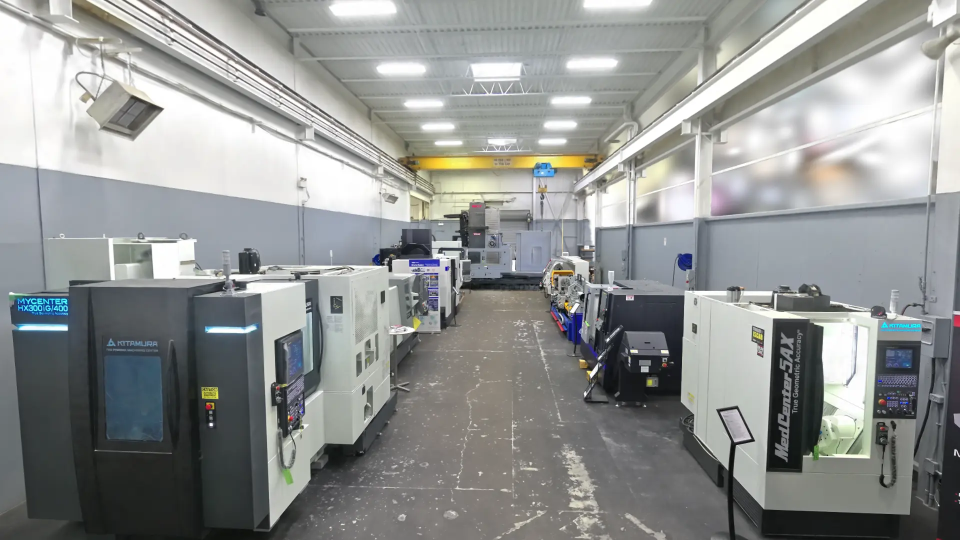
That makes 3DGS particularly good at preserving complex visual detail—reflections, fine equipment shapes, clutter and the overall appearance of a machine shop—without manually modelling every object.
What is the difference between LiDAR and 3DGS?
Mobile SLAM LiDAR records planning-grade spatial geometry while the scanner moves; 3DGS reconstructs photoreal appearance. Axial Spaces can combine them so a manufacturing team has both planning context and a recognizable facility experience. SLAM result quality depends on the route, loop closure, environment, surfaces, control and accumulated drift.
| Question | Industrial LiDAR | 3D Gaussian Splatting |
|---|---|---|
| Primary role | Spatial geometry and measurement context | Photoreal visual understanding |
| Underlying representation | Measured point cloud | Oriented translucent Gaussians learned from imagery |
| Best suited to | Existing-condition reference, layout context and downstream geometry workflows | Remote review, communication and recognizing the real facility |
| Important boundary | Planning-grade mobile SLAM context—not automatically survey- or metrology-grade | Not the sole authority for critical dimensions |
3DGS versus LiDAR, point clouds, photogrammetry and CAD
| Representation | Best at | Important limit |
|---|---|---|
| 3DGS Gaussian splat | Photoreal, free-viewpoint visualization | Not inherently a watertight engineering model |
| LiDAR point cloud | Measured spatial points and geometric reference | Less visually intuitive for non-technical users |
| Photogrammetry mesh | Textured surface geometry from imagery | Can struggle with reflective, repetitive or low-texture surfaces |
| NeRF | Novel-view photoreal rendering | Traditional NeRF rendering can be heavier than 3DGS |
| CAD/BIM model | Structured design geometry and documentation | Requires modelling effort and may omit real-world clutter |
What is a 3D facility twin?
A 3D facility twin is a reusable, browser-accessible spatial record of a real facility at a stated capture date and version. It helps people review existing conditions, discuss changes and coordinate decisions without all being on site.
A 3DGS reconstruction can become the visual reality layer of a digital twin. It gives people a recognizable facility they can enter and discuss. LiDAR adds measured spatial context. Tags, documents, project geometry, viewpoints or asset information can then make the environment more useful.
The phrase digital twin is often stretched too far. A captured 3D facility is a spatial twin; it does not become a live operational twin until it is connected to changing business or machine data. Keeping that distinction clear builds trust and helps a manufacturer buy only the layer it currently needs.
Is an Axial Spaces facility twin a live digital twin?
No—not unless live sensor, machine or operational data is actually connected. The standard facility twin is a captured spatial twin. It records what was visible at a date and version; it does not claim to represent changing plant conditions automatically.
| Capability | Captured spatial twin | Live operational digital twin |
|---|---|---|
| Represents | A facility at a stated capture date and version | Changing states from connected systems |
| Typical inputs | LiDAR, imagery, 3DGS, tags, viewpoints and scoped project files | Sensor, machine, production or enterprise data plus a spatial or logical model |
| Updates | Recapture or revise when the facility changes | Data connections update defined properties continuously or on a schedule |
| Axial Spaces base deliverable | Yes | No—not unless separately engineered and explicitly scoped |
Why manufacturing facilities are a strong 3DGS use case
Plants are hard to explain with isolated photographs. Equipment, structure, aisles, access, utilities and production constraints interact spatially. A Gaussian splat lets a remote stakeholder see those relationships in recognizable context.
Practical uses include safety reviews, equipment-move briefings, contractor orientation, plant-layout discussions, training, before-and-after records and project communication. The value is not that the scene looks impressive; it is that several people can finally discuss the same place.
Can you measure from a Gaussian splat?
Reference measurement may be possible in a correctly scaled and aligned scene, but a Gaussian splat should not be the sole authority for critical dimensions.
A scene can support reference measurement when it is correctly scaled and aligned, but the visual splat should not be treated as the sole authority for critical dimensions. Axial Spaces keeps LiDAR and 3DGS roles separate: the splat communicates appearance; the underlying spatial data supports planning context.
Required tolerances should be defined before capture. Certified survey, machine alignment, engineered fit or other high-consequence verification needs the appropriate professional scope and measurement method.
What should a client ask before commissioning a 3DGS capture?
- Who needs to use the result, and on which devices?
- Is the goal visual communication, measurement context, CAD coordination or all three?
- What areas, viewpoints and conditions must be captured?
- What accuracy or control requirements apply?
- Will the scene need labels, guided routes, documents or project models?
- How will sensitive facility information be hosted and shared?
CAPTURE A REAL FACILITY
Need a Gaussian splat people can actually use?
Axial Spaces builds industrial 3DGS and LiDAR facility experiences from Ingersoll, Ontario, serving manufacturing projects across Southern Ontario.
Scope My Facility Project