

RESPONSIBLE REALITY CAPTURE
Mobile SLAM LiDAR accuracy & limitations.
Axial Spaces uses mobile SLAM LiDAR while walking a planned route through the facility. It is well suited to planning-grade existing-condition context, but route design, loop closure, environmental geometry, surfaces and accumulated drift affect the result. No blanket survey- or metrology-grade claim is made.
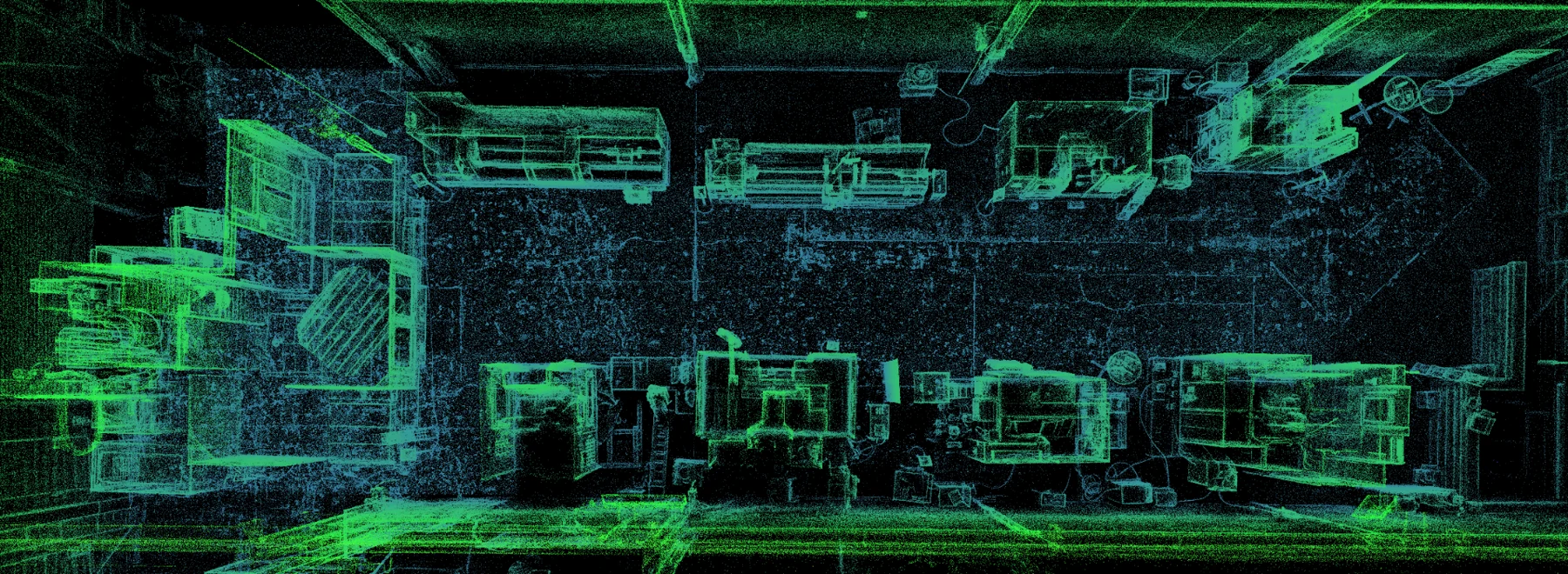
How does mobile SLAM LiDAR work?
SLAM means simultaneous localization and mapping. The scanner records laser returns while the system estimates its position as the operator moves through the plant. Those observations are registered into a point cloud of visible facility surfaces.
The route is part of the measurement process. Revisited geometry can support loop closure; long, repetitive or poorly connected paths can allow error to accumulate. Facility size, environmental geometry, surface characteristics, movement, control and processing all influence the result.
How accurate is mobile SLAM LiDAR?
There is no responsible single accuracy number for every mobile SLAM LiDAR project. Result quality depends on the scanner, route, SLAM solution, loop closure, environment, control, processing, distance to surfaces and the deliverable being evaluated.
Axial Spaces uses the term planning-grade to mean spatial context that is useful for feasibility, layout comparison, access review and coordination when the required tolerance has been discussed. It does not mean that every visible point or reference measurement is certified for construction, machine alignment or legal boundary work.
Planning-grade versus survey- or metrology-grade capture
| Capture level | Appropriate use | Control and authority | Do not assume |
|---|---|---|---|
| Planning-grade mobile SLAM LiDAR | Existing-condition context, layout options, route review, preliminary fit-up, stakeholder coordination and documentation | Planned route, coverage and project-specific checks as scoped | Certified coordinates, precision fit, machine alignment or code compliance |
| Survey-controlled capture | Work requiring traceable control, registered coordinates or defined survey tolerances | Control network and methodology specified for the project; licensed surveyor where required | That adding targets alone makes every output survey-grade |
| Metrology-grade measurement | Machine alignment, component inspection, precision fit and tolerance-critical verification | Calibrated instruments, controlled procedure and a qualified metrology specialist | That a facility-scale mobile scan replaces precision inspection |
What can limit a mobile LiDAR capture?
| Condition | What can happen | How it is managed |
|---|---|---|
| SLAM drift | Small registration errors can accumulate along long, repetitive or poorly connected routes. | Plan loop closures, preserve recognizable geometry, add control where the decision requires it and verify key relationships. |
| Occlusions | Equipment, stock, guarding and people block line of sight, leaving hidden surfaces uncaptured. | Capture from multiple positions and list areas or surfaces that remain excluded. |
| Reflective metal and glass | Mirrors, polished surfaces and transparent glass can produce sparse, displaced or missing returns. | Treat questionable surfaces explicitly and verify critical geometry by another method. |
| Moving objects | Forklifts, cranes, people and moving equipment can create partial or conflicting observations. | Coordinate the route and timing; recapture important areas when conditions settle. |
| Inaccessible areas | Locked, hazardous, elevated or obstructed areas cannot be represented completely. | Record the exclusion and determine whether separate access or specialist capture is required. |
Can a facility be scanned while production is running?
Often yes, but it is a planning decision—not a blanket promise. A capture route can sometimes work around normal production. Traffic, hazards, moving machinery, confidentiality, restricted areas and the need for unobstructed views may require pauses, escorts or a different shift.
The pre-capture plan identifies operating constraints, safe access and important areas that cannot be accepted as occluded or incomplete.
When is survey control required?
Specify survey control when the output must tie to a required coordinate system, when registration drift must be constrained to an agreed tolerance, or when downstream work depends on traceable positions. The control design and the professional responsible for it should be agreed before capture.
Use a licensed surveyor for regulated surveying, legal boundaries or survey certification; an engineer for engineered design and sign-off; and a metrology specialist for machine alignment or precision inspection. Axial Spaces can provide the facility context those professionals work from without representing their authority.
What measurement can a facility twin support?
Reference measurements can help compare options and identify what needs field verification. A Gaussian splat is primarily the photoreal visual layer; LiDAR or another controlled geometry source provides the measurement context. Critical dimensions should be verified from the agreed source and method rather than estimated from appearance alone.
DEFINE THE DECISION AND TOLERANCE
Scope the capture around what must be trusted.
Tell Axial Spaces which facility decision the record must support and which dimensions carry real consequences.
Scope My Facility Project