

Point-cloud and spatial data
Processed mobile SLAM LiDAR geometry can be supplied in agreed project formats for downstream viewing, planning and specialist workflows, with its intended-use limits stated.
MOBILE SLAM LIDAR CAPTURE · ONTARIO
Axial Spaces walks a planned route through the facility while mobile SLAM LiDAR records visible surfaces and estimates the scanner position. Your team receives a planning-grade spatial record for existing-condition review, CNC installation planning, equipment moves, layout discussions and coordination.
REAL CAPTURE · SOUTHERN ONTARIO
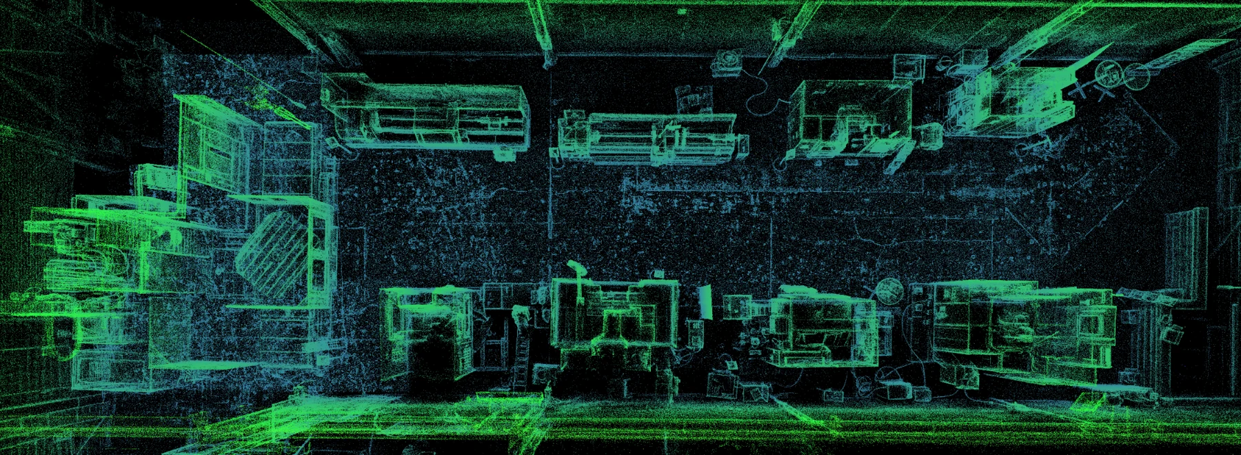
This fly-through comes from a Southern Ontario machine-tool showroom and demonstration facility. It shows the LiDAR-derived point-cloud view a team can use to understand equipment, aisles, structure and the relationships between them.
Top-down LiDAR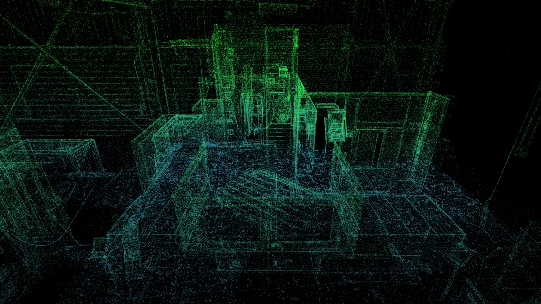 Machine-level geometry
DELIVERABLES, SCOPED TO THE DECISION
Processed mobile SLAM LiDAR geometry can be supplied in agreed project formats for downstream viewing, planning and specialist workflows, with its intended-use limits stated.
A navigable online view can combine spatial context, guided viewpoints and a recognizable facility experience for non-specialist stakeholders.
Reference measurements, annotations, named locations and guided viewpoints can be prepared around the questions your team needs to answer.
Depending on scope, outputs can include 2D plan imagery, structured layout geometry, snapshots, fly-through video and project exports. Exact formats are confirmed before capture.
WHAT YOUR TEAM GAINS
Bring remote stakeholders into the same captured facility instead of relying on memory, scattered photos or repeated walkthroughs.
Review relationships between floors, structure, equipment, access and surrounding conditions before detailed validation begins.
Browser-ready viewing, LiDAR point-cloud data, guided locations, reference measurements and project-specific outputs are scoped as needed.
SLAM means simultaneous localization and mapping. As the operator walks through the plant, the scanner records laser returns while the SLAM system estimates its changing position and builds the surrounding map.
The route is planned to maintain useful coverage, revisit geometry for loop closure and reduce weak areas. Facility size, repetitive geometry, reflective or absorptive surfaces, movement, lighting for colour imagery, route design and accumulated drift can all affect the result.
Mobile SLAM LiDAR records visible surfaces as millions of spatial points. In a manufacturing facility, that point cloud can preserve the relationship between equipment, structure, floor areas, aisles, services and access conditions in one coordinated planning dataset.
Axial Spaces pairs that geometry with familiar visual context where useful. The result can support technical and non-technical conversations without asking every participant to interpret a raw point cloud.
The planning-grade point cloud can support existing-condition review, early layout work, machine-placement conversations, preliminary fit-up, access discussions, remote review, asset documentation and decisions about where controlled field checks are needed.
It should not be promoted as a universal replacement for survey control, precision metrology, fabrication dimensions, machine alignment, engineered design or professional compliance review.
The capture is most valuable when several people need to understand the same physical constraint: an equipment move, a shutdown task, a safety concern, an expansion concept, contractor access or a facility change that is difficult to explain with drawings alone.
A good project starts with that decision. Scanner type, coverage, detail and deliverables follow from what the team needs to see, measure, compare or communicate.
Axial Spaces does not make a blanket numerical, survey-grade or metrology-grade accuracy claim for mobile SLAM LiDAR. Facility size, equipment, scan path, loop closure, environment, surfaces, control, processing and accumulated drift all matter.
The intended use and required tolerance are discussed before capture. Fabrication, construction, machine alignment, code compliance and other high-consequence dimensions require independent verification using the appropriate controlled method and qualified professional.
Derek Rozon brings more than 30 years of CNC and manufacturing experience to the capture. That changes the questions asked on site: production flow, access, workholding, machine service, people, safety, capacity and the consequences of disrupting a working plant.
The aim is not to hand over an impressive dataset and disappear. It is to make the facility easier for your team to use in the decisions that follow.
HOW A PROJECT MOVES
Identify the facility area, stakeholders, tolerances, outputs and decision the capture must support.
Confirm operating conditions, restricted areas, timing, confidentiality, the capture route and useful loop closures before arriving on site.
Walk the planned route, review SLAM registration and coverage, process the LiDAR and imagery, and build the agreed spatial views and outputs.
Walk through the result with the people making the decision and confirm what requires further measurement or engineering validation.
STRAIGHT ANSWERS
Axial Spaces uses mobile SLAM LiDAR: laser returns record visible facility surfaces while simultaneous localization and mapping estimates the scanner position as the operator moves. The resulting point cloud is a planning-grade spatial record that can be viewed, measured, exported and combined with other project information.
Often the capture can be planned around normal operations, but the answer depends on traffic, hazards, restricted areas, moving equipment and the detail required. Safety and access conditions are confirmed before the site visit.
Depending on scope: a browser-ready facility view; LiDAR point-cloud data; LCC/LCC2, PLY, USD or 3D Tiles outputs where appropriate; guided viewpoints; annotations; planning-grade reference measurements; 2D or structured-layout outputs; snapshots; fly-through video; and project exports. The useful subset is confirmed before capture rather than delivering every possible format by default.
No blanket survey-grade or metrology-grade claim is made. The standard mobile SLAM LiDAR workflow is intended for facility planning, equipment layout, preliminary fit-up, remote review and documentation. Critical or tolerance-sensitive dimensions must be independently verified using the appropriate controlled measurement method and qualified professional.
Focused decision-capture projects start around CAD $1,500. Full-facility capture, facility twins, equipment-move planning, hosting and specialized deliverables are quoted by scope.
START WITH ONE REAL FACILITY
Focused decision-capture projects start around CAD $1,500. Full-facility capture, facility twins, equipment-move planning, hosting, and specialized deliverables are quoted by scope.
Scope My Facility Project